
By Okoi Obono-Obla
Something earthshaking and fundamental to Africa’s development happened on Friday, 5 September 2026, in the hallowed, wood-panelled chambers of the United Nations General Assembly.
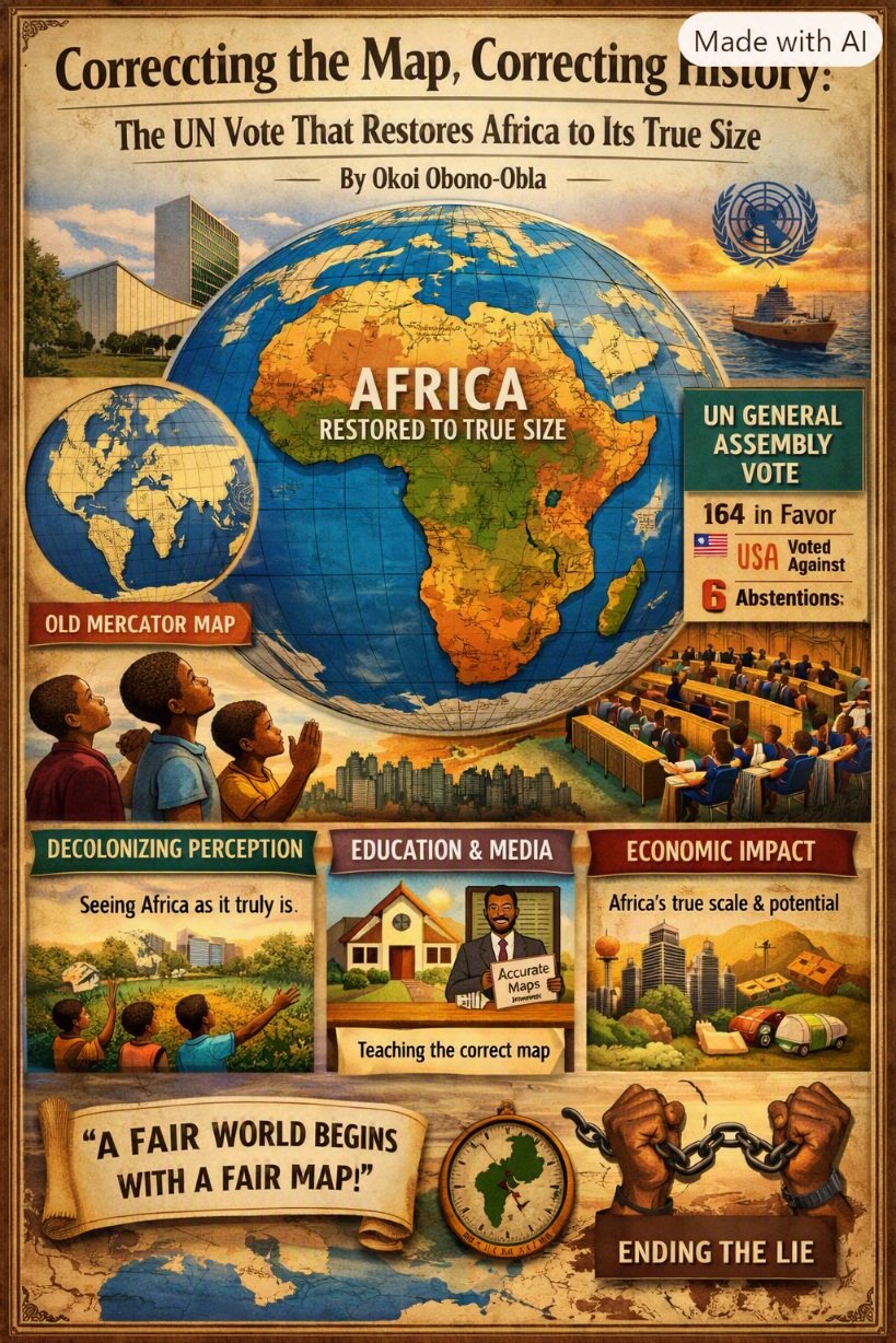
The Assembly endorsed a new world map that represents Africa in its true, larger size, in what has been described as the culmination of a campaign led by African countries and advocacy groups. The resolution, titled “Correct the Map: rebalancing global cartographic representation and promoting equitable representation of the world’s regions, particularly Africa,” was sponsored by the Republic of Togo on behalf of the African Group and backed by the African Union.
It passed with 164 member states voting in favour. Only the United States voted against it, while six countries — Serbia, Estonia, Georgia, Lithuania, Moldova and Ukraine — abstained.

The vote encourages governments and institutions around the world to replace the traditional Mercator map, commonly used since the 16th century, with the Equal Earth projection that geographers say shows locations more accurately.
This is not a cartographic technicality. It is a decolonial act.
For nearly 500 years, the world has seen itself through the eyes of one man: Gerardus Mercator, the Flemish cartographer who in 1569 drew a map for European navigators to cross oceans. The Mercator projection was brilliant for its purpose — holding a compass bearing. But what was brilliant for navigation became disastrous for perception. To flatten a sphere, it enlarged regions near the poles and shrank those near the Equator.
The result: a deliberate visual lie. In the Mercator map, Greenland and Africa appear to be about the same size, whereas in reality Africa is 14 times larger than Greenland. The distortion is not trivial. Africa covers 30.37 million square kilometres (11.7 million square miles). It is larger than China (9.6 million km²), Canada (9.98 million km²), the United States (9.8 million km²) and Europe (10.18 million km²) combined. Canada and Russia look like giants. Africa looks manageable. That is the imperial prism through which the world has been taught to see itself — the Global North as expansive and dominant, the Equatorial world as shrunken and peripheral.
It is a misnomer to think a map is just for travellers. Maps shape our understanding of the world. They guide education, nourish the imagination, and influence collective perceptions, as Togo’s Foreign Minister Robert Dussey reminded the General Assembly. Maps are power.
Who has been most diminished by this lie? Precisely the African nations that straddle the Equator — the heart of the continent.
The Democratic Republic of Congo (2.34 million km²), larger than Greenland itself yet drawn as a fraction of it; the Republic of Congo, Gabon, São Tomé and Príncipe, Equatorial Guinea, Cameroon, Central African Republic, Uganda, Kenya, Rwanda, Burundi, Somalia and South Sudan. Beyond them, the entire belt of West and East Africa within ten degrees of the Equator — Nigeria, Ghana, Côte d’Ivoire, Liberia, Sierra Leone, Ethiopia and northern Tanzania — has been visually reduced.
When you shrink a place on a map, you shrink it in the mind.
That is why Friday’s vote matters far beyond geography. First, it restores psychological sovereignty. An African child who sees her continent as large as it truly is cannot be told she comes from a small place.
Second, it corrects education. Africa No Filter, one of the lead campaigners, captured it best: “We want to see accurate maps in schools, textbooks, newsrooms, businesses and on the digital platforms billions of people use every day.”
Third, it has hard economic consequences. Investment follows perception. A continent that looks small looks like a small market, a small opportunity, a small risk worth ignoring. A continent shown in its true 30 million km² scale asserts its weight: 1.4 billion people, 60% of the world’s uncultivated arable land, 30% of mineral reserves, and the future demographic centre of the world. You cannot price Africa correctly if you cannot see Africa correctly.
Finally, it is an act of truth. As French Foreign Minister Jean-Noël Barrot said after the vote, “Changing the map obviously doesn’t change the world. But correcting a representation that distorts it is already an act of truth.”
Let it be clear: the resolution does not ban Mercator. It does not impose a replacement but only encourages the use of the Equal Earth projection, a 2018 projection that follows the Earth’s curvature and shows continents in their true proportions. Mercator remains useful at sea. Outside of that very narrow navigation application, there is no point in using it, as Syracuse University geographer Mark Monmonier notes.
For five centuries, we navigated with Europe’s compass. On 5 September 2026, Africa finally began to navigate with its own size.
A fair world, indeed, begins with a fair map.