
By Okoi Obono-Obla
My friend Omowumi Alaaya has shifted the goalpost from geography to maritime delimitation, and in doing so concedes my core point.
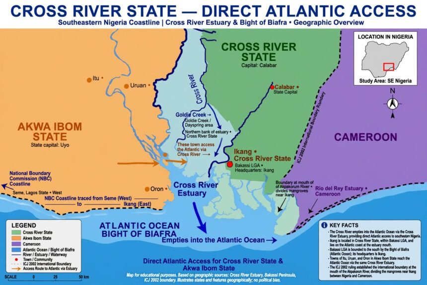
My write-up was never about 76 oil wells, RMAFC indices, or the 200m isobath. It was a simple geographic proposition which remains uncontradicted: The Cross River empties into the Atlantic Ocean, Ikang is in Cross River State, and Ikang is on the Atlantic coast. Therefore Cross River State has direct access to the Atlantic without jumping Cameroon.
Alaaya says because Itu, Uruan and Oron also access the ocean via the estuary they are of the same status. With respect, that argument proves my case, not his. If Itu, Uruan and Oron have access to the ocean via the estuary, then a fortiori Cross River State, which owns the estuary’s northern bank from Goldie Creek to Dayspring, also has access. You cannot argue that Akwa Ibom is littoral through the same estuary and Cross River is landlocked through the same estuary.

On the law of the sea:
Alaaya invokes “IMO guidelines and UNCLOS perpendiculars.” UNCLOS Articles 5, 7 and 15 indeed use the low-water baseline and perpendicular/equidistance lines to delimit the territorial sea and continental shelf. But UNCLOS does not determine whether a coastline exists; it presupposes that a coastline exists. You draw a baseline because there is a coast. The perpendicular is a method of projection, not a method of erasing geography.
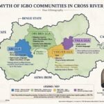
The National Boundary Commission’s own publications show the Cross River Estuary extending seaward into the Atlantic forming a defined littoral outlet. The official description of Nigeria’s coastline remains from Seme in the West to Ikang in Cross River State in the East. You cannot have a coastline that ends in a State that is landlocked.
The ICJ judgment of 2002 never declared Cross River landlocked. What the ICJ did was to place the international boundary at the mouth of the Akpakorum River, dividing the mangrove near Ikang, giving a portion of the Ikang mangrove to Cameroon. A portion, not the whole estuary. The Supreme Court in 2005 refused to draw a Cross River/Akwa Ibom maritime boundary because the Nigeria-Cameroon Mixed Commission had not finished its work. By 2012 it relied on the fact that Bakassi had been ceded to hold that for purposes of derivation Cross River had no seaward boundary. That is a legal fiction for revenue allocation, not a geographic finding that the Atlantic dried up at Ikang.
To say we must first fault the ICJ before we can question the Supreme Court is to misunderstand our jurisprudence. The Supreme Court can be revisited on fresh and compelling evidence of fraud, misrepresentation or new mapping data. The Cross River Water Map Survey showing identifiable communities – Esuk Mba, Essighi, Akpangkanya, Goldie Creek to Dayspring – with direct Atlantic frontage was not before the Court in 2012. That is new evidence.
The reference to INE fishing camps of Oron, Eket, Uduan, Itu before colonial contest is historically interesting but legally irrelevant to State creation in 1967 and to sovereignty. Fishing does not create territory, and Germany and Britain were not contesting fishing camps but colonial delimitation.
Finally, I am not claiming the 76 oil wells today. I am saying let us get the geography right. You cannot say the boundary between Nigeria and Cameroon is in Akwa Ibom – the land boundary is in Cross River State at Ikang. What abuts Akwa Ibom is the maritime projection after Ikang.
Painful as it is, the political stalemate will not be resolved by calling Cross River landlocked when every official map shows Bakassi LGA bounded in the South by the Bight of Biafra, the Atlantic Ocean, with headquarters at Ikang.