

An Analytical Submission by Ibrahim BUNU
Email: ibrahimbunu2520@gmail.com
Introduction: The Map That Outlived the Empire
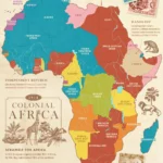
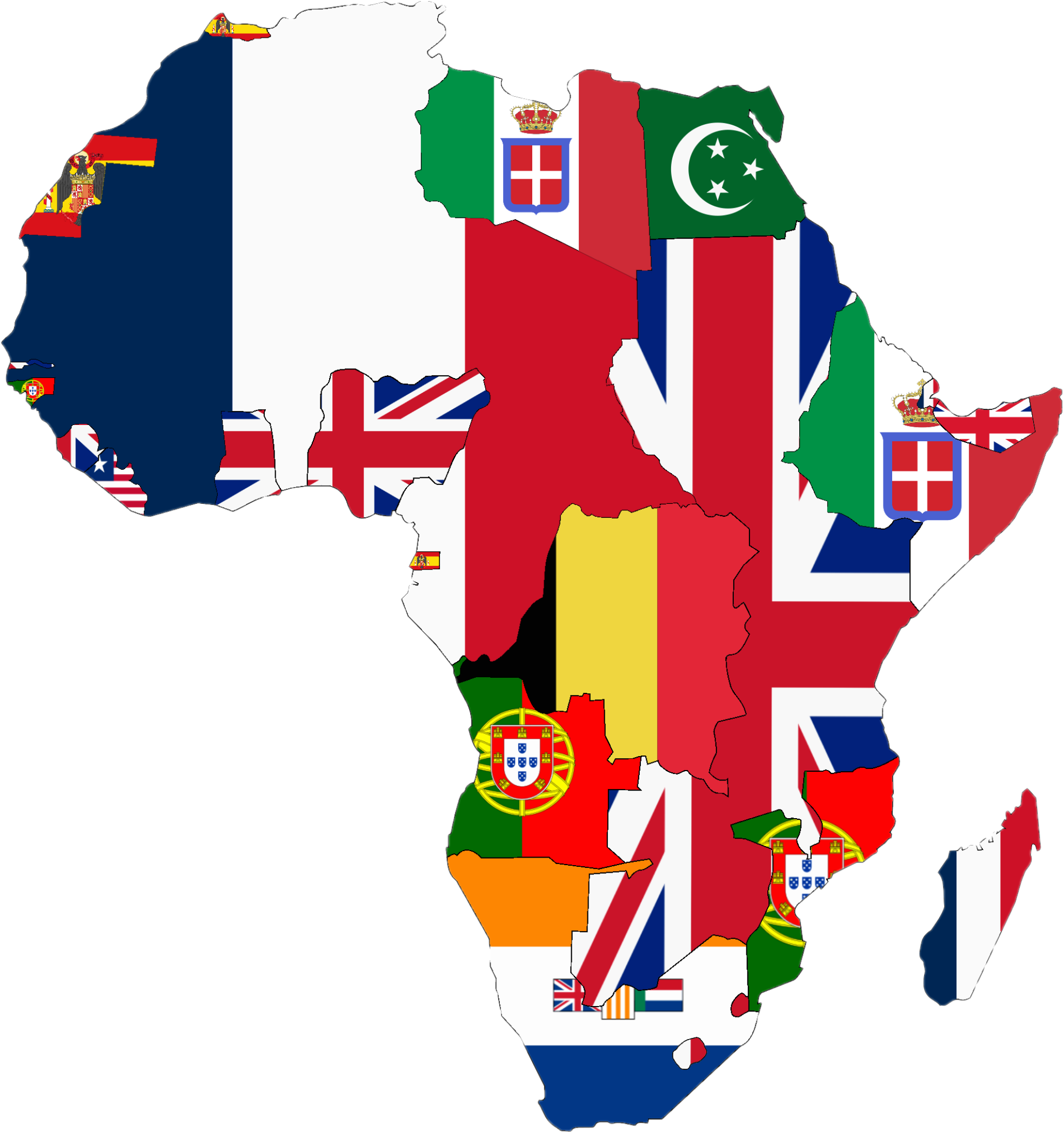
One of the most consequential acts in modern African history was not a battle, a treaty signed by Africans, or a democratic decision. It was the drawing of borders by European colonial powers during the late nineteenth and early twentieth centuries. Those lines, often sketched in distant European capitals, survived the collapse of colonial rule and became the boundaries of modern African states.
The central argument of this analysis is not that colonial borders alone explain Africa’s contemporary challenges, but that they fundamentally altered the political geography of the continent in ways that continue to shape governance, identity, security, and regional politics. The often-cited example of the Hausa people divided between present-day Nigeria and Niger provides a useful lens through which to examine the broader colonial strategy commonly described as “divide and rule” or “divide and conquer.”
This submission expands that argument by examining the historical evidence, the logic of colonial administration, the Nigerian–Nigerien Hausa case, and the long-term implications for state formation in Africa.
1. The Historical Context: Why Europe Drew Africa’s Borders
Between 1884 and 1885, European powers met at the Berlin Conference, where they established rules for claiming African territory. Contrary to popular simplifications, the conference did not produce every African border in detail, but it legitimized the scramble for African territory and accelerated the partition of the continent.
European powers had several objectives:
* Control trade routes and resources
* Secure strategic territories
* Prevent rival European powers from gaining dominance
* Expand imperial prestige
In pursuing these goals, colonial officials frequently relied on maps that were incomplete or inaccurate. Ethnographic knowledge was limited, and local political systems were poorly understood. As a result, many boundaries followed rivers, latitude lines, longitude lines, or negotiated spheres of influence rather than existing cultural or political realities.
Vital point: The key historical fact is that African societies were rarely consulted when these borders were established.
2. The Logic of Divide and Rule
The phrase “divide and rule” refers to a governing strategy in which a dominant power reduces the likelihood of unified resistance by encouraging or maintaining divisions among subordinate groups. This strategy was used in various empires, including the British, French, and Roman empires.
In the African colonial context, divide and rule operated through several mechanisms:
A. Administrative Separation
Different ethnic groups were often governed through distinct local authorities, customary courts, or administrative units.
B. Differential Access to Education and Employment
Colonial powers sometimes invested unevenly in different regions, creating disparities that later became politically significant.
C. Manipulation of Traditional Authorities
Some chiefs were empowered, others weakened, and in certain cases entirely new “traditional” authorities were created.
D. Territorial Partition
Ethnic communities that had previously interacted within broader political or commercial networks were placed under separate colonial administrations.
Important nuance: Historians debate whether every border was intentionally designed to split ethnic groups. In many cases, the divisions resulted from European bargaining, geographic convenience, and limited knowledge rather than a documented master plan to fragment every African nation. However, once such divisions existed, colonial administrations often used them to their advantage.
3. The Hausa Example: A Contiguous People Across Colonial Frontiers
The Hausa are one of the largest ethnolinguistic groups in West Africa. Before colonial conquest, Hausa-speaking communities were linked by:
* Shared language
* Trade networks
* Islamic scholarship
* Intermarriage
* Political connections among Hausa city-states and the Sokoto Caliphate
When Britain and France expanded into the region, they eventually established a boundary that placed:
* Most Hausa populations south of the boundary under British rule (Northern Nigeria)
* Significant Hausa populations north of the boundary under French rule (Niger)
This was not a minor demographic accident. Today, Hausa communities remain prominent on both sides of the Nigeria–Niger border, and cross-border interaction continues through commerce, migration, religion, and family ties.
What Changed After Partition?
Before Partition
After Partition
Shared regional networks
Different colonial administrations
Common commercial space
Separate customs and taxation systems
Unified Islamic scholarly circuits
Distinct colonial education policies
Fluid political interaction
International frontier after independence
Vital point: The Hausa case demonstrates how a culturally connected population became embedded in two different state-building projects.
1. Was the Split Deliberate? Evaluating the Evidence
A rigorous analysis must distinguish between documented intent and inferred strategic effect.
Evidence Supporting Deliberate Fragmentation
* Colonial officials were aware that large, cohesive political entities could pose challenges to imperial control.
* European powers frequently negotiated boundaries with little regard for local identities.
* Once boundaries were established, colonial administrations often discouraged political movements that transcended their territories.
Evidence Against the Strongest Claim
* Historians have not produced evidence that European powers systematically set out to “cut every African nation in half.”
* Some ethnic groups were indeed divided, but others were incorporated largely within a single colony.
* Many borders reflected competition among European powers rather than a coordinated continent-wide conspiracy.
The most defensible conclusion is that colonial border-making was primarily driven by imperial competition and administrative convenience, but it had the effect—and was sometimes used with the intention—of fragmenting existing political and cultural communities.
1. Nigeria: A State Assembled From Multiple Historical Worlds
Nigeria is often cited as a quintessential multi-ethnic colonial state. The territory combined regions with different historical trajectories:
* The Sokoto Caliphate and other northern emirates
* Yoruba kingdoms in the southwest
* Igbo and other acephalous or decentralized societies in the southeast
* Numerous Middle Belt and Niger Delta communities with distinct political traditions
The 1914 amalgamation of Northern and Southern Nigeria by the British was motivated largely by administrative and financial considerations, not by a shared Nigerian national identity. The resulting state contained hundreds of ethnic groups and multiple religious traditions.
Consequences
* Competition over political power became intertwined with regional and ethnic identity.
* Federalism emerged as a mechanism for managing diversity.
* Census figures, revenue allocation, and representation became highly contentious.
Vital point: Nigeria’s complexity is not simply the product of colonialism—precolonial diversity was real—but colonial amalgamation institutionalized that diversity within a single state framework.
1. The Cross-Border Problem: Kinship Beyond the State
When ethnic communities span international borders, several dynamics emerge:
A. Economic Integration
Traders often operate across borders regardless of official restrictions. The Nigeria–Niger border has long been characterized by extensive informal commerce.
B. Social Continuity
Families may have relatives in multiple countries, reducing the psychological significance of the border.
C. Security Challenges
States may struggle to monitor movement across borders that local populations have historically crossed freely.
D. Political Sensitivities
Governments may worry that cross-border ethnic solidarity could influence domestic politics.
These dynamics are not unique to the Hausa. Similar patterns exist among the Somali, Ewe, Tuareg, Maasai, and many other African peoples.
1. The Long Shadow of Colonial Borders
After independence, African leaders faced a difficult choice:
1. Redraw borders to reflect ethnic realities, risking widespread territorial conflict; or
2. Retain colonial boundaries, despite their imperfections.
In 1964, the Organization of African Unity (OAU) adopted the principle of respect for existing borders. This decision was pragmatic: virtually every African state contained cross-border ethnic communities, and revising boundaries could have triggered endless disputes.
The Paradox
* Colonial borders were often arbitrary.
* Changing them could be even more destabilizing.
As a result, the colonial map became the foundation of postcolonial sovereignty.
1. A Deeper Analytical Model: Fragmentation, Centralization, and Elite Competition
To move beyond slogan-level explanations, we can model the process in three stages.
Stage 1: Precolonial Networks
Ethnic and political communities interacted through trade, religion, migration, and warfare. Boundaries were often zones of influence rather than fixed lines.
Stage 2: Colonial Territorialization
European powers converted fluid frontiers into fixed administrative borders, imposed taxation, and created centralized colonial bureaucracies.
Stage 3: Postcolonial Elite Competition
After independence, political elites competed for control of the inherited state. Because the state controlled access to revenue, employment, and patronage, ethnic and regional identities became politically mobilized.
Critical insight: The enduring challenge is not merely that borders were arbitrary, but that highly centralized states were built on top of societies whose historical networks did not necessarily correspond to those territorial units.
1. Common Misconceptions
Misconception 1: “All African borders were completely arbitrary.”
Some borders did follow preexisting political or geographic features, though many did not align well with cultural boundaries.
Misconception 2: “Colonialism created all African ethnic identities.”
Most major ethnic identities predated colonial rule, although colonial administration sometimes hardened or redefined them.
Misconception 3: “If borders matched ethnic groups, conflict would disappear.”
Many conflicts occur within relatively homogeneous states, and ethnic groups themselves are internally diverse.
Misconception 4: “The Hausa were split solely to weaken them.”
The split resulted from the broader Anglo-French partition of West Africa; whether weakening the Hausa was a primary objective remains historically unproven.
1. Why This Matters Today
Understanding colonial border-making is essential for several contemporary issues:
Regional Security
Insurgent groups and criminal networks can exploit porous borders and cross-border social ties.
Economic Integration
Artificial borders sometimes divide natural commercial regions, increasing transaction costs.
Identity Politics
Citizens may maintain strong ethnic affiliations that coexist with, rather than replace, national identity.
Governance Reform
Debates about federalism, decentralization, and regional autonomy often reflect attempts to reconcile inherited state structures with underlying social realities.
1. The Strongest Defensible Thesis
A historically grounded thesis would be:
European colonial powers partitioned Africa primarily according to imperial strategic interests rather than indigenous political and cultural boundaries. This process frequently divided ethnolinguistic communities, including the Hausa across present-day Nigeria and Niger. Although historians debate the extent to which such divisions were intentionally designed to prevent unified resistance, the resulting borders fragmented existing regional networks and contributed to the complex multi-ethnic character of many postcolonial African states. The persistence of these colonial boundaries continues to influence governance, identity, security, and economic integration across the continent.
This formulation is analytically strong because it:
* Acknowledges the documented historical facts
* Avoids overstating evidence of intent
* Explains both immediate colonial effects and long-term postcolonial consequences
* Connects the Hausa example to broader African patterns
Final Reflection: The Map Is Not the Territory
The most profound legacy of colonial border-making is not simply that lines were drawn across Africa. It is that those lines transformed how political authority, citizenship, and identity were organized. The Hausa trader moving between Kano and Maradi, the Tuareg moving across the Sahara, or the Ewe family divided between Ghana and Togo all illustrate a fundamental reality: the social geography of Africa often extends beyond the territorial geography of the modern state.
Therefore, the real analytical question is not whether colonial borders were arbitrary—they often were—but how states can build inclusive political communities despite borders that did not emerge from a shared national compact. Africa’s future stability may depend less on redrawing the map than on designing institutions capable of accommodating the historical networks that the map never fully erased.
By Ibrahim BUNU
Email: ibrahimbunu2520@gmail.com