By Okoi Obono-Obla
Iran’s Geography: A Treacherous Battlefield for Foreign Armies:
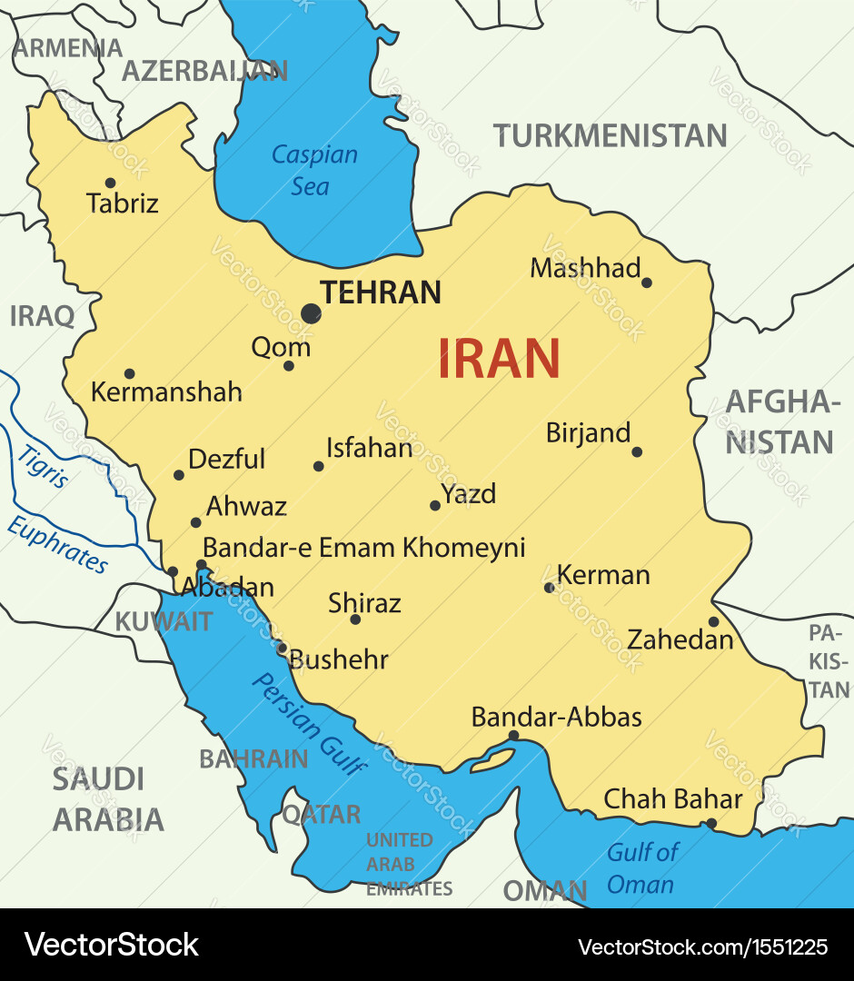
Iran is significantly larger than Nigeria in land area. Iran covers approximately 1,648,195 square kilometres, making it roughly 1.78 times larger than Nigeria, which has a total area of about 923,768 square kilometres. Iran is the 17th largest country in the world, while Nigeria is 43% smaller in comparison. Iran has a population of about 93 million people.
Iran’s Spartan and rugged topography—comprising mountains, salt lakes, wetlands, deserts, and high elevations—makes it a formidable terrain for military operations. Engaging Iranian forces within their own territory would be a daunting task, as they are deeply familiar with the ecosystem and landscape. Fighting Iran inside its borders would be far more dangerous and challenging than what the United States experienced in Vietnam, Afghanistan, and Iraq.
Iran is geographically larger than six major European countries combined: Germany, France, the Netherlands, Belgium, Spain, and Italy.
Iran’s Treacherous Terrain
Major Mountain Ranges
– Alborz Mountains (north, near the Caspian Sea) – includes Mount Damavand, Iran’s highest peak at 5,610 m.
– Zagros Mountains (west and southwest, extending into Iraq).
– Kopet Dag Mountains (northeast, bordering Turkmenistan).

Salt Lakes
– Lake Urmia (northwest, one of the largest salt lakes in the Middle East).
– Dasht-e Kavir (Great Salt Desert) – central Iran, with salt flats and marshes.
Wetlands and Marshes
– Shadegan Wetland (southwest, near Khuzestan).
– Miankaleh Wetland (north, near the Caspian Sea).
– Hamun Wetlands (southeast, near the Afghanistan border).
Deserts
– Dasht-e Kavir (Great Salt Desert) – central plateau.
– Dasht-e Lut (Lut Desert) – southeastern Iran, one of the hottest places on Earth.
Elevated Heights
– Much of Iran lies on the Iranian Plateau, with elevations ranging from 1,000–1,500 m above sea level.
– Rugged highlands dominate most of the country, making mobility and logistics extremely difficult for foreign armies.
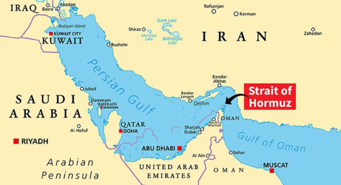
Strategic Maritime Challenge: Strait of Hormuz
The Strait of Hormuz is a narrow waterway connecting the Persian Gulf and the Gulf of Oman. It is one of the most critical chokepoints for global oil transport. Any naval assault through this strait faces Iran’s coastal defenses, mines, and missile systems, making it a dangerous route for foreign vessels attempting to launch attacks toward southern Iran.
Conclusion:
Iran’s vast size, population, and treacherous terrain—mountains, deserts, wetlands, and salt lakes—make it a formidable challenge for any foreign military force. Coupled with the strategic Strait of Hormuz, Iran’s geography ensures that fighting within its territory would be far more dangerous and complex than U.S. experiences in Vietnam, Afghanistan, or Iraq.


Leave a comment