
By Agbonmagbe Kazeem
1950-75
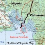
In the first installment titled “The Bakassi”, we reviewed a very brief summary of the history of the dispute starting from the Treaty between England and Old Calabar in 1884 all the way through to the ICJ judgement of October 10, 2002. Those who want more information about the fall of Calabar should consult “Politics and Society in South Eastern Nigeria” by KK Nair or “Old Calabar 1600-1891” by AJH Latham. A nice summary is available in “The Fall of Nigeria – The British Conquest” by Obaro Ikime (Heinemann, 1977). In Part 2, we shall focus more specifically on the twenty-five-year period from 1950 to 1975.
COUNTDOWN TO THE UN PLEBISCITE
1949 – 1954
As we noted previously, following the Second World War, League of Nation mandates were replaced by UN mandates. Dr. E. M. L. Endeley became President of the Cameroon National Federation in 1949. At that time southern Cameroons (including Bakassi peninsula) was administered with Nigeria. Following a dispute within the Eastern House of Assembly in Enugu in May 1953, nine out of thirteen delegates from the Southern Cameroons, who had originally been elected on the platform of the National Council for Nigeria and the Cameroons (NCNC), opted for ‘neutrality’, claiming that they were not Nigerian. Mr. S. T. Muna, the only Southern Cameroonian in the Eastern Executive Council at that time was actually dismissed. This crisis led to the name change from “National Council for Nigeria and the Cameroons”, as the NCNC was then known, to “National Council of Nigerian Citizens.“
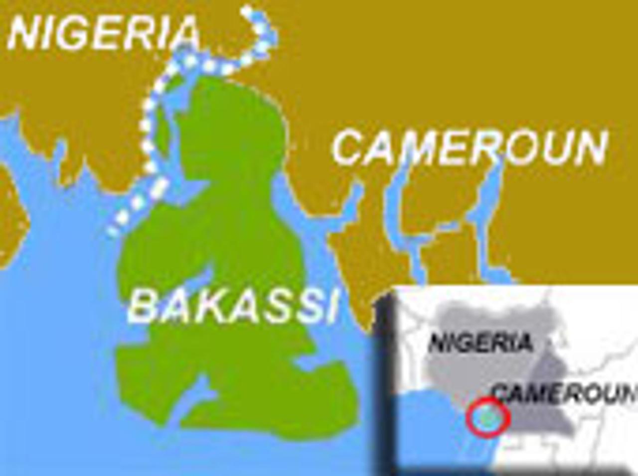
During the July 1953 London Constitutional Conference, Endeley, citing fear of “Nigerian domination”, requested the unconditional withdrawal of the Southern Cameroons from the Eastern Region of Nigeria, and its transformation into a separate region of its own in line with its trusteeship status. Britain agreed and implemented separation in 1954, making the Southern Cameroons (including Bakassi peninsula) a semi-autonomous quasi-region of the Nigeria Federation with its own House of Assembly and Executive Council located at Buea. Endeley was called the Leader of Government Business, not Premier, primarily because Southern Cameroons was not yet a full region. Importantly, the Bakassi peninsula which was part of Kamerun/Cameroon since 1913, as inherited in the league of Nations mandate after World War 1, was also excised from co-administration with the eastern region along with the rest of the southern Cameroons at that time. There is no evidence that anyone made an issue of the matter then (Nigeria Gazette No. 53 vol. 41, B389-408; [D440-59]).
1955 – 1960
In 1955 there was a split in Endeley’s party which was then allied with the Action Group (AG) and John Ngu Foncha emerged as his rival on the platform of the new Kamerun National Democratic Party (KNDP). This party’s goal was complete secession of southern Cameroons from Nigeria and eventual reunification with Francophone Cameroun. Endeley was accused of abandoning his former stance of pro-unification in favor of integration with Nigeria. At about the same time the Union des Populations Camerounaises (UPC), a Bamileke based radical leftist party in Francophone Cameroun led by Felix Moumie was being banned by the French Governor. As they fought a bitter and violent guerrilla war against ruthless French troops, they would often cross over to Bamileke sections of British Cameroons (i.e. “Nigeria”) for sanctuary.

In mid 1957, there was a Constitutional Conference in London to resolve issues preparatory to Nigeria’s independence which was initially proposed for a date in 1959, but “not later than April 2, 1960.” In August that year, Tafawa Balewa became Premier in an All Nigeria Federal Executive Council. Among the first three Federal Ministers from the Eastern region was a gentleman called Okoi Arikpo. He would later feature in the post-independence Gowon government.
On September 25th the Willink Commission was set up to deal with the case of Nigerian minorities. Interestingly, no submission was made to the panel regarding the case of Bakassi peninsula, considered then to be part of southern Cameroons. The Willink report was published in October 1958 – recommending against the creation of new regions in Nigeria. Shortly thereafter the Constitutional conference resumed in London – and once again the Bakassi issue was not discussed, nor was the status of Calabar as a former “protectorate” rather than “colony” as some have said, an issue.
In the January 1959 southern Cameroons election (in which Bakassi residents participated), Endeley was voted out of power and replaced by Foncha, a man with even less disguised anti-Nigerian instincts. In October that year, the Enugu based 1st Queens Own Nigeria regiment (1QONR) was temporarily deployed to southern Cameroons for “Training”. However, Bamileke UPC sympathizers in Bamenda viewed this as a counter-insurgency deployment in support of the hated French colonial administration. In early 1960, responding to more violence in the area, the 1QONR again returned to Bamenda area in full force, followed shortly thereafter by the 4QONR from Ibadan who were deployed further south to Kumba near the coast. The 5QONR and 3QONR later replaced both battalions respectively – followed later by the 2QONR. These shows of military force did not endear Nigeria to certain opinion leaders in the local population.
On October 1, 1960 Nigeria became independent. Our first Prime Minister, Alhaji Tafawa Balewa signed an exchange of notes with the United Kingdom saying (inter alia), that
“….it is the understanding of the Government of the United Kingdom of Great Britain and Ireland that the Government of the Federation of Nigeria agree to the following provisions:
“(i) all obligations and responsibilities of the Government of the United Kingdom which arises from any valid international instrument shall, henceforth, in so far as such instrument may be held to have application to Nigeria, be assumed by the Government of the Federation of Nigeria.
(ii) the rights and benefits heretofore enjoyed by the Government of the United Kingdom in virtue of the application of any such international instrument to Nigeria shall henceforth be enjoyed by the Government of the Federation of Nigeria……..”
By customary international law, therefore, “Nigeria” inherited (and agreed without question) all the present international boundary regimes of Nigeria – with Dahomey (Benin), Niger, Chad and Cameroon – as originally defined by various colonial Anglo-French and Anglo-German Treaties. Therefore, the southern Cameroons (inclusive of the Bakassi peninsula), which was now under separate direct British rule as a trusteeship territory, asked Nigerian troops to leave. A British Battalion replaced them.
However, 1QONR, supported by the new Recce Unit of the newly independent Nigerian Army were then deployed in an internal security precaution along the frontier to prevent spill-over of violence. The old Anglo-German border of 1913 was resurveyed at this time by Nigerian military foot patrols to confirm the location of old beacons and new Police Posts were constructed along it for clarity. [NJ Miners: The Nigerian Army 1956-1966, Methuen 1971, page 73-74]
It was against this background that most southern Cameroonians favored self-determination – independent of BOTH Nigeria and Francophone Cameroun. However, conflicting interests on the international scene subverted their political will. The pan-Africanist movement, led by Nkrumah, for example, was opposed to the emergence of small African states. Britain was initially afraid that an allegedly economically unviable “Southern Cameroons” would be an albatross around its taxpayers and thus preferred that it join with large Nigeria next door. Although southern Cameroonian leaders preferred that the plebiscite provide a simple choice between “integration with Nigeria” or “secession and independence”, the UN imposed different questions on the electorate. In October 1959, General Assembly Resolution 1352 XIV, composed the choices as follows:
(I) Do you wish to achieve independence by joining the independent Federation of Nigeria?
or
(II) Do you wish to achieve independence by joining the independent Republic of Cameroun?
However, popular opposition to these choices compelled both Foncha and Endeley to request that southern Cameroons simply be granted independence. Initial momentum in this direction and talks in London in November 1960, however, collapsed in acrimony and the UN had its way. In the countdown to the plebiscite, reunification with Francophone Cameroun was marketed by well-funded Francophone groups as a loose union in which the Southern Cameroons would maintain self-rule. The most prominent among these pro-unification forces were elements of the Bamileke tribe who was split by the post-World War 1 partition into British and French territories. Its own arrangements for independence in 1960 and infighting among its leaders in the meantime distracted Nigeria, following the controversial federal elections of 1959.
Simultaneously, the refusal of Britain to create new regions for ethnic Nigerian minorities at the London constitutional talks of 1958 made it easy for pro-unification forces in southern Cameroons. They mischievously advertised integration with Nigeria as a reunion with the Eastern region from which it had “broken away” in 1954. The effect of this was amplified by short-sighted Nigerian politicians who were afraid that the integration of southern Cameroons would provide the eastern region based NCNC with a larger geographic and political base in the tri-regional rat race to control Nigeria.
THE PLEBISCITE
In October 1961, therefore, following the UN Plebiscite of February 11th, the Southern Cameroons (including the Bakassi peninsula) was federated with the Republic of Cameroun, while the Northern Cameroons joined Nigeria. Thus, by default, and by plebiscite, the Nigeria-Cameroun boundary in the south – as described by the Section F of the Legal Notice 126 of 1954-58 – and clearly marked with resurveyed 1913 beacons, reverted to the old Anglo-German border which antedated Nigeria’s amalgamation. An Anglo-French treaty following the partition of German Kamerun after World War 1 specified the portion in the North.
The results of the plebiscite in the North were heavily influenced by the single-mindedness, leadership and strategic genius of the Sardauna of Sokoto, the late Alhaji Ahmadu Bello, assisted by Mr D.J.M. Muffett, then Resident General in the Northern Cameroons. Cameroun reacted unfavorably to it and even went to the ICJ to file a complaint that voting was irregular. However, the complaint was not sustained. The results in the south reflected personal, ethnic and political rivalries within southern Nigeria and Cameroon, confusing interpretation of the plebiscite questions on the part of villagers, background influence from Francophone interests, and failure of the Nigerian intelligentsia and government to appreciate the strategic implications of what was going on. It would prove to be a costly oversight down the road.
Nevertheless, Nigeria, perhaps not wanting to rock the boat, having successfully staved of Cameroun’s challenge to the northern Cameroons plebiscite, voted at the UN to approve the results of the southern Cameroons plebiscite, oblivious to certain subtle issues of legality, due process and self-interest that were lurking in the background. Never too comfortable with the idea, but thinking it could win autonomy, anglophone Southern Cameroon (along with Bakassi in the southwestern district) departed on an uncertain journey to its future with Francophone Cameroun.
1962
In 1962, Nigeria confirmed its approval of the results of the plebiscite in a Diplomatic Note No. 570 of March 27, 1962 to Cameroun, which included a map showing Bakassi in the newly unified Cameroun. From then on, until the 1990s Nigeria would have no serious administrative or military presence in the peninsula. [Even the much-touted ‘Bakassi local government’ was only created in 1997, a full three years AFTER the case at the ICJ had begun]. During the first republic, in addition to the Embassy in Yaounde, however, Nigeria opened a consulate in Buea, capital of the Southern Cameroons – now Western Cameroun. Presumably this was in recognition of the large number of Nigerians living in the region, even after the plebiscite.
ORGANIZATION OF AFRICAN UNITY (OAU)
1963
In 1963, the Organization of African Unity (OAU) was established. Article III, paragraph 3 of the founding Charter states: “Respect for the sovereignty and territorial integrity of each state and for its inalienable right to independent existence.” Nigeria ratified this Charter.
1964
In 1964, Nigeria approved the Cairo Declaration of the Organization of African Unity of July 1964, committing African States to the inviolability of colonial borders. Specifically, AHG/RES 16(1) states: “Solemnly declares that all Member States pledge themselves to respect the borders existing on their achievement of national independence.” Nigeria ratified this declaration, and by implication restated its commitment to the Nigerian-Cameroun colonial border, as it had done in 1960 (Exchange of Notes with the UK) and again in 1962 (Diplomatic Note 570).
BOUDAN AND DANARE DISPUTE
1965
In 1965, a number of border incidents took place between two villages – Boudan and Danare – near Ikom, in a forested area of the old boundary. A joint Nigeria-Cameroun boundary demarcation team was set up and sent to the area. The late Surveyor O.A. Aqua as well as Surveyor Dennis Mbata represented Nigeria. Cameroun was represented, among others by late Surveyor G. Obenson (who later became a Professor at the University of Lagos). As had previously been confirmed in 1960, the area was well demarcated by the colonial administration (based on the 1913 Treaty) but the beacons were too far apart. Thus the purpose of the exercise was to place intervisible beacons along the old 1913 boundary. This exercise was suspended on account of the military coup of January 1966 – and never resumed until after the civil war.
NIGERIA IN CRISIS
1966
In late 1966, in the tense circumstances following the northern counter-rebellion of July 29, a plane carrying weapons – allegedly ordered by Eastern region Military Governor Lt. Col. Ojukwu – and headed for Enugu in Nigeria’s eastern region crashed over the Cameroun mountains. It remains unclear to this day whether the crash was accidental or the plane was shot down. But Cameroun’s President Ahidjo, who was not informed beforehand of the flight’s planned overpass through Camerounian air space, was highly irritated and embarassed. He would, from that point onwards, view the Ojukwu leadership in Eastern Nigeria – and later Biafra – with suspicion.
1967
After the events of late 1966, but before the civil war actually broke out, Douala airport in Cameroun was a favorite destination of foreign-based Ndigbo returning to the Eastern region. It was also a favourite route for getting out of Nigeria until the border areas were partially secured by federal Nigerian Troops during the war. In late May 1967, following the mandate granted to Lt. Col. Ojukwu by the Eastern Consultative Assembly to secede Lt. Col. Gowon created 12 new States in Nigeria – including the South-Eastern State headed by Major U. J. Esuene, an Ibibio officer in the Air Force. The creation of the South-Eastern State from the former eastern region was not unnoticed across the border and was a factor in rekindling interest in rejoining Nigeria among Efik and Ibibio residents of Bakassi peninsula – many of whom had actually voted in 1961 not to pursue integration with Nigeria. Indeed, Nigeria’s Consul-General at Buea, SJ King, transferred from the foreign service to his home South-Eastern State where he later became the Permanent Secretary.
CALABAR SECTOR DURING THE CIVIL WAR
In July, the Nigerian Civil War broke out – and lasted until January 1970. During the war, both Nigeria and Biafra were in an international rat race for support and recognition. Nigeria lobbied its neighbors to prevent Biafra from using their territory as either a staging point for military operations or through-put for weapons supply. Very early in the campaign a decision was made to create a vise around Biafra by attacking simultaneously from the North and the sea. During operations to take Calabar on October 17 – 19, the threat of the Bakassi peninsula being used to outflank and surprise the Nigerian task force and dominate the approach channel to the Calabar estuary became an issue, necessitating more specific diplomatic exchanges with Cameroun to clarify its intentions. In fact, troops of the 12 Brigade, 3rd Marine Commando under Major (later Lt. Col.) R. Aliyu, reporting to Colonel (later Brigadier) B. Adekunle, supported by naval and air bombardment, could not break out from Calabar for almost a month, only barely holding on to the town.
Major Ogbo Oji of the 9th battalion, 52 Biafran Bde, initially led the Biafran resistance at Calabar (until he was badly wounded). The Brigade had no Commander after Colonel Eze was removed in curious circumstances (Madiebo: The Nigerian Revolution and the Biafran War, Fourth Dimension Publishers, 1980). Lt. Col. David Okafor who was later reinforced by Lt. Col. Adigio of the 7th battalion replaced Oji. They were both later replaced – in controversy – by Majors Odigwe and Omerua under a newly formed 56 Brigade under Lt. Col Festus Akagha who had barely escaped – in controversial circumstances – from the Midwestern theater. European mercenaries later took over that front. To show its importance to Biafra, nearly all-available ammunition – which was never enough to begin with – was sent to that front. Nigeria got assurances from Cameroun that the Bakassi peninsula – which Nigeria had acknowledged as far back as 1962 was in Cameroun and, therefore, outside its control – would not be used by hostile elements. This pre-empted contingency plans for “hot pursuit” operations across the border and safeguarded the rear as federal troops slowly pushed east of the Cross river against initially determined Biafran troops who, nevertheless, were eventually undermined by internal conflicts within the Biafran political, administrative and military structure.
The federal plan was to link up through Oban with 1st Division federal elements coming down from Ikom against Biafran forces led by Lt. Col. Ochei. The objective was to cut off the Biafran border point with Cameroun at Ikang. This was finally achieved in December. However, the road to Ikom along with the towns of Ikot Okpara, Amolo Water Town, Mbabu Owa and Agobi-Iwolo were not taken until the end of January 1968, courtesy of a controversial Biafran withdrawal ordered by European mercenaries hired by Ojukwu. Note that in his book “My Command” written by General Obasanjo (rtd) and published by Heinemann in 1981, all the maps of that sector show the Bakassi peninsula in Cameroun (page 93). In his book “The Struggle for Secession, 1966-1970. Frank Cass, 1971” N.U. Akpan, the Secretary to the Eastern Regional and later Biafran government, who is himself of South-Eastern origin, also shows the Bakassi peninsula in Cameroun in a map titled “Map of Eastern Nigeria declared Biafra, 30th May, 1967” (page 20). The war did not begin until July 6th.
To be continue…..
“THE HISTORIAN”
AGBONMAGBE REMILEKUN KAZEEM
+2348036472826